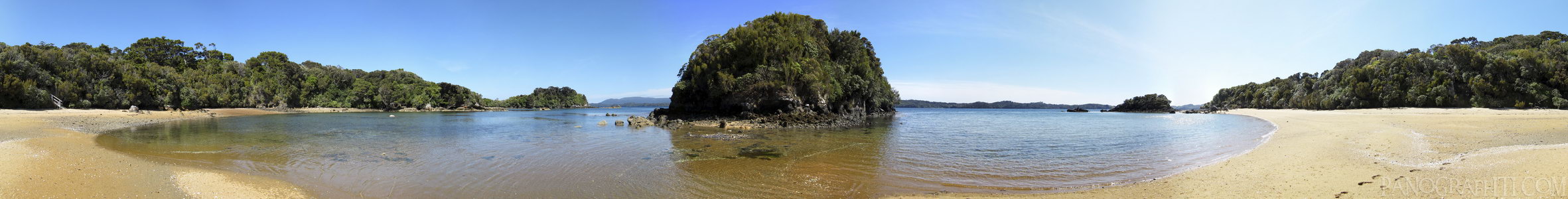
West Beach on Ulva Island 360
MAP
Bay
Beach
Island
December 10th, 2011 on Saturday at 10:46 AM
35.2MP 360x43 Cylindrical
27mm f4.0 400/s ISO80
Stewart Island, Southland, New Zealand
18 places and 104 pans within 521 km
Southland - 50 km North
Southland, New Zealand
Catlins - 103 km North-East
Southland, New Zealand
Queenstown - 206 km North
Otago, New Zealand
Fiordland - 214 km North-West
Fiordland National Park, Southland, New Zealand
Dunedin - 218 km North-East
Otago, New Zealand
Glenorchy - 221 km North
Otago, New Zealand
Arrowtown - 227 km North
Otago, New Zealand
Otago Peninsula - 230 km North-East
Otago, New Zealand
Otago - 266 km North-East
Otago, New Zealand
Wanaka - 274 km North
Otago, New Zealand
Haast Pass - 289 km North
West Coast, New Zealand
Omarama - 310 km North-East
Otago, New Zealand
Mount Cook National Park - 366 km North-East
Canterbury, New Zealand
Lake Tekapo - 374 km North-East
Canterbury, New Zealand
West Coast - 418 km North
West Coast, New Zealand
Christchurch - 517 km North-East
Canterbury, New Zealand
Banks Peninsula - 518 km North-East
Canterbury, New Zealand
Arthur's Pass National Park - 521 km North-East
Canterbury, New Zealand
9 pans at Stewart Island
Ringaringa Point
Rocks Around Ringaringa Beach
Boat Sheds Around Golden Bay
Ringaringa Beach
Post Office Bay on Ulva Island
Horseshoe Point 360
Rocks Around Lee Bay
Ulva Island Forest
Back 6 of 9
Stewart Island
Southland, New Zealand
You are at the 7th of 9 panoranics
Click on the panoramic to zoom in
or select an option from the side
Next 8 of 9
Back
Close
## of ###
Visit
Next


 Back 6 of 9


 Close
Close

