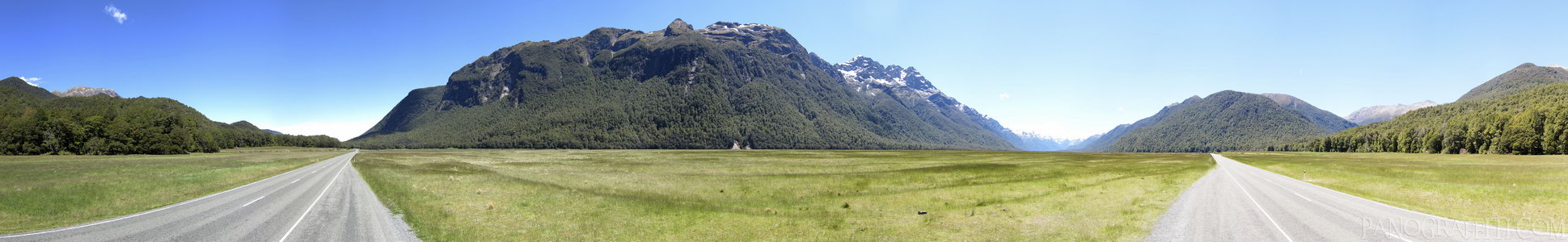
Milford to Te Anau Highway 360
MAP
Stitched Panorama
Road
December 4th, 2011 on Sunday at 1:56 PM
58.9MP 360x49 Cylindrical
27mm f2.2 1000/s ISO80
Fiordland, Southland, New Zealand
18 places and 104 pans within 420 km
Glenorchy - 41 km East
Otago, New Zealand
Queenstown - 55 km East
Otago, New Zealand
Arrowtown - 68 km East
Otago, New Zealand
Wanaka - 111 km North-East
Otago, New Zealand
Haast Pass - 116 km North-East
West Coast, New Zealand
Southland - 163 km South
Southland, New Zealand
Omarama - 172 km North-East
Otago, New Zealand
Catlins - 193 km South-East
Southland, New Zealand
Stewart Island - 203 km South
Southland, New Zealand
Mount Cook National Park - 210 km North-East
Canterbury, New Zealand
Otago - 209 km East
Otago, New Zealand
Dunedin - 216 km South-East
Otago, New Zealand
Lake Tekapo - 230 km North-East
Canterbury, New Zealand
Otago Peninsula - 225 km East
Otago, New Zealand
West Coast - 246 km North-East
West Coast, New Zealand
Arthur's Pass National Park - 372 km North-East
Canterbury, New Zealand
Christchurch - 409 km North-East
Canterbury, New Zealand
Banks Peninsula - 420 km East
Canterbury, New Zealand
9 pans at Fiordland
Flight Over The Milford Track
Eglinton River HDR
Hollyford River HDR
South Side of Homer Tunnel South in Southland
Lake Te Anau HDR
Middle Fiord at Lake Te Anau HDR
Stirling Falls in Milford Sound
Fjords of Milford Sound HDR
Back 2 of 9
Fiordland
Fiordland National Park, Southland, New Zealand
You are at the 3rd of 9 panoranics
Click on the panoramic to zoom in
or select an option from the side
Next 4 of 9
Back
Close
## of ###
Visit
Next


 Back 2 of 9


 Close
Close

