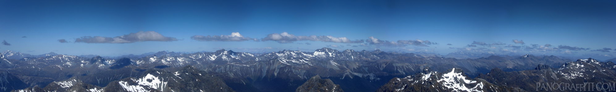
Flight Over The Milford Track
MAP
Family
Mountain
Snow
November 29th, 2011 on Tuesday at 4:33 PM
29.6MP 66x11 Planar
101mm f4.9 833/s ISO80
Fiordland, Southland, New Zealand
18 places and 104 pans within 426 km
Glenorchy - 54 km East
Otago, New Zealand
Queenstown - 75 km South-East
Otago, New Zealand
Arrowtown - 81 km East
Otago, New Zealand
Wanaka - 114 km East
Otago, New Zealand
Haast Pass - 115 km North-East
West Coast, New Zealand
Southland - 189 km South
Southland, New Zealand
Omarama - 178 km East
Otago, New Zealand
Catlins - 221 km South-East
Southland, New Zealand
Stewart Island - 229 km South
Southland, New Zealand
Mount Cook National Park - 208 km North-East
Canterbury, New Zealand
Otago - 227 km East
Otago, New Zealand
Dunedin - 239 km South-East
Otago, New Zealand
Lake Tekapo - 232 km North-East
Canterbury, New Zealand
Otago Peninsula - 248 km South-East
Otago, New Zealand
West Coast - 239 km North-East
West Coast, New Zealand
Arthur's Pass National Park - 368 km North-East
Canterbury, New Zealand
Christchurch - 413 km East
Canterbury, New Zealand
Banks Peninsula - 426 km East
Canterbury, New Zealand
9 pans at Fiordland
Eglinton River HDR
Milford to Te Anau Highway 360
Hollyford River HDR
South Side of Homer Tunnel South in Southland
Lake Te Anau HDR
Middle Fiord at Lake Te Anau HDR
Stirling Falls in Milford Sound
Fjords of Milford Sound HDR
Haast Pass
West Coast, New Zealand
4 more pans
November 27th, 2011
2 days prior
Fiordland
Fiordland National Park, Southland, New Zealand
You are at the first of 9 panoranics
Click on the panoramic to zoom in
or select an option from the side
Next 2 of 9
Back
Close
## of ###
Visit
Next


 Close
Close
