East Face of Mt Ruapehu
MAP
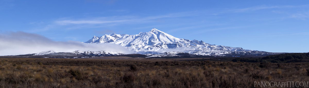
Looking west towards Mount Ruapehu from the Desert Road
Mountain
Snow
Volcano
July 21st, 2013 on Sunday at 2:14 PM
4.1MP 42x12 Planar
80mm f10.0 500/s ISO200
Desert Road, Manawatu-Wanganui, New Zealand
8 places and 53 pans within 121 km
Tongariro Alpine Crossing - 11 km West
Tongariro National Park, Manawatu-Wanganui, New Zealand
Tongariro National Park - 21 km West
Manawatu-Wanganui, New Zealand
Lake Taupo - 56 km North-East
Taupo, Waikato, New Zealand
Waikato River - 60 km North-East
Taupo, Waikato, New Zealand
Taupo - 62 km North-East
Waikato, New Zealand
Manawatu-Wanganui - 87 km South
Manawatu-Wanganui, New Zealand
Wai-O-Tapu - 102 km North-East
Waiotapu, Bay of Plenty, New Zealand
Hawke's Bay - 121 km East
Hawke's Bay, New Zealand
4 pans at Desert Road
Mt Ruapehu and Ngauruhoe from the Desert Road
Mt Ruapehu and Ngauruhoe in Black and White HDR
Mount Ngauruhoe and Ruapehu from the Desert Road in HDR
Back 1 of 4
Desert Road
Manawatu-Wanganui, New Zealand
You are at the 2nd of 4 panoranics
Click on the panoramic to zoom in
or select an option from the side
Next 3 of 4
Back
Close
## of ###
Visit
Next


 Back 1 of 4


 Close
Close

