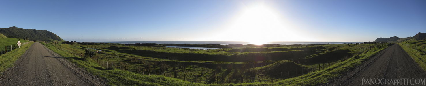
East Cape Lighthouse Road
MAP
The gravel road on the drive out to the most eastern part of New Zealand
Road
May 18th, 2011 on Wednesday at 7:55 AM
30.5MP 188x35 Cylindrical
27mm f5.0 500/s ISO80
East Cape, Waikato, New Zealand
The easternmost point of the North Island is located near Gisborne
6 places and 35 pans within 237 km
Gisborne - 100 km South
Gisborne, New Zealand
White Island - 118 km West
Bay of Plenty, New Zealand
Bay of Plenty - 200 km West
Bay of Plenty, New Zealand
Wai-O-Tapu - 203 km West
Waiotapu, Bay of Plenty, New Zealand
Hawke's Bay - 217 km South-West
Hawke's Bay, New Zealand
Taupo - 237 km South-West
Waikato, New Zealand
3 pans at East Cape
Tokomaru Bay Moonrise in HDR
East Cape Lighthouse Sunrise and Moonset
Back 2 of 3
East Cape
Waikato, New Zealand
You are at the last of 3 panoranics
Click on the panoramic to zoom in
or select an option from the side
White Island
Bay of Plenty, New Zealand
7 more pans
May 19th, 2011
2 days later
Back
Close
## of ###
Visit
Next


 Back 2 of 3


 Close
Close

