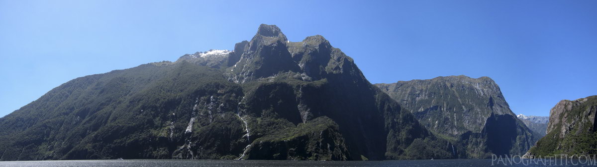
Stirling Falls in Milford Sound
MAP
Family
Mountain
Waterfall
November 29th, 2011 on Tuesday at 2:11 PM
15.9MP 138x34 Cylindrical
31mm f2.8 1000/s ISO80
Fiordland, Southland, New Zealand
18 places and 104 pans within 418 km
Glenorchy - 63 km South-East
Otago, New Zealand
Queenstown - 87 km South-East
Otago, New Zealand
Arrowtown - 87 km South-East
Otago, New Zealand
Wanaka - 108 km East
Otago, New Zealand
Haast Pass - 105 km East
West Coast, New Zealand
Southland - 214 km South
Southland, New Zealand
Omarama - 171 km East
Otago, New Zealand
Catlins - 243 km South-East
Southland, New Zealand
Stewart Island - 255 km South
Southland, New Zealand
Mount Cook National Park - 195 km East
Canterbury, New Zealand
Otago - 233 km East
Otago, New Zealand
Dunedin - 251 km South-East
Otago, New Zealand
Lake Tekapo - 220 km East
Canterbury, New Zealand
Otago Peninsula - 259 km South-East
Otago, New Zealand
West Coast - 222 km North-East
West Coast, New Zealand
Arthur's Pass National Park - 353 km North-East
Canterbury, New Zealand
Christchurch - 403 km East
Canterbury, New Zealand
Banks Peninsula - 418 km East
Canterbury, New Zealand
9 pans at Fiordland
Flight Over The Milford Track
Eglinton River HDR
Milford to Te Anau Highway 360
Hollyford River HDR
South Side of Homer Tunnel South in Southland
Lake Te Anau HDR
Middle Fiord at Lake Te Anau HDR
Fjords of Milford Sound HDR
Back 7 of 9
Fiordland
Fiordland National Park, Southland, New Zealand
You are at the 8th of 9 panoranics
Click on the panoramic to zoom in
or select an option from the side
Next 9 of 9
Back
Close
## of ###
Visit
Next


 Back 7 of 9


 Close
Close

