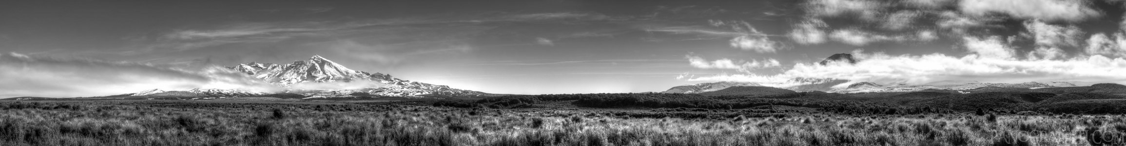
Mt Ruapehu and Ngauruhoe in Black and White HDR
MAP
Black and white HDR from 3 exposures brackets and post processed in Photomatix
Mountain
Volcano
July 21st, 2013 on Sunday at 2:33 PM
34.3MP 51x7 Spherical
80mm f11.0 833/s ISO200
Desert Road, Manawatu-Wanganui, New Zealand
8 places and 53 pans within 121 km
Tongariro Alpine Crossing - 11 km West
Tongariro National Park, Manawatu-Wanganui, New Zealand
Tongariro National Park - 21 km West
Manawatu-Wanganui, New Zealand
Lake Taupo - 56 km North-East
Taupo, Waikato, New Zealand
Waikato River - 60 km North-East
Taupo, Waikato, New Zealand
Taupo - 62 km North-East
Waikato, New Zealand
Manawatu-Wanganui - 87 km South
Manawatu-Wanganui, New Zealand
Wai-O-Tapu - 102 km North-East
Waiotapu, Bay of Plenty, New Zealand
Hawke's Bay - 121 km East
Hawke's Bay, New Zealand
4 pans at Desert Road
Mt Ruapehu and Ngauruhoe from the Desert Road
East Face of Mt Ruapehu
Mount Ngauruhoe and Ruapehu from the Desert Road in HDR
Back 2 of 4
Desert Road
Manawatu-Wanganui, New Zealand
You are at the 3rd of 4 panoranics
Click on the panoramic to zoom in
or select an option from the side
Next 4 of 4
Back
Close
## of ###
Visit
Next


 Back 2 of 4


 Close
Close

