Uruoukapuka Island - 360 degree view from the top of Uruoukapuka Island while hike during on a sailing trip in the Bay of Islands.
MAP

360 degree view from the top of Uruoukapuka Island while hike during on a sailing trip in the Bay of Islands.

March 9th, 2010 on Tuesday at 11:32 AM 30.7MP 281x36 Cylindrical 27mm f5.0 500/s ISO80

Bay of Islands, Northland, New Zealand New Zealand

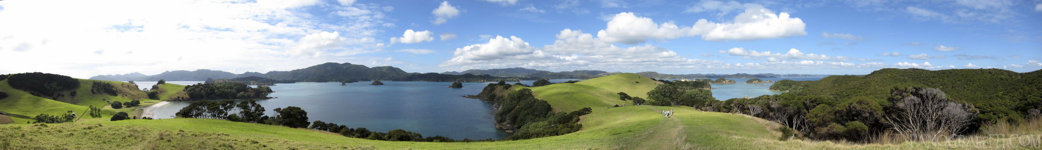
The Bay of Islands is a natural harbor on the north east coast of New Zealand. Cruises to the end of Cape Brett Peninsula offer a view of the Hole in the Rock on Motukokako Island and hikes on Uruoukapuka Island.

Previous Pan Back 1 of 7
Bay of Islands
Northland, New Zealand

You are at the 2nd of 7 panoranics

Click on the panoramic to zoom in
or select an option from the side
Next 3 of 7 Next Pan
Zoom
 
 
Panoramic
Previous
Next
Loading...