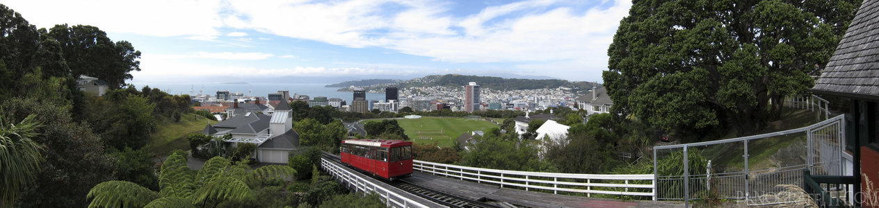
Wellington Cable Car
MAP
A view of Welly from the iconic Cable Car lookout at the top of the botanical gardens
City
Lookout
March 20th, 2010 on Saturday at 1:12 PM
28.2MP 158x42 Panini
27mm f4.5 500/s ISO80
Wellington, Wellington, New Zealand
20 places and 114 pans within 310 km
Mount Victoria - 4 km East
Wellington, New Zealand
Wellington Harbour - 5 km East
Wellington, New Zealand
Lyall Bay - 7 km South-East
Wellington, New Zealand
Kapiti Coast - 40 km North-East
Wellington, New Zealand
Cape Palliser - 42 km South-East
Wellington, New Zealand
Picton - 64 km West
Marlborough, New Zealand
Motueka - 150 km West
Tasman, New Zealand
Abel Tasman National Park - 150 km West
Tasman, New Zealand
Kaikoura - 153 km South-West
Canterbury, New Zealand
Manawatu-Wanganui - 166 km North
Manawatu-Wanganui, New Zealand
Nelson Lakes National Park - 170 km West
Nelson, New Zealand
Tongariro National Park - 241 km North
Manawatu-Wanganui, New Zealand
Desert Road - 250 km North
Manawatu-Wanganui, New Zealand
Tongariro Alpine Crossing - 251 km North
Tongariro National Park, Manawatu-Wanganui, New Zealand
Taranaki - 269 km North-West
Taranaki, New Zealand
Punakaiki - 290 km West
West Coast, New Zealand
Hawke's Bay - 300 km North-East
Hawke's Bay, New Zealand
Christchurch - 306 km South-West
Canterbury, New Zealand
Lake Taupo - 307 km North
Taupo, Waikato, New Zealand
Banks Peninsula - 310 km South-West
Canterbury, New Zealand
10 pans at Wellington
Abandoned Chest Hospital Theater Room
Solace of the Wind Statue
Illuma Light Show
Rugby World Cup 2011
Wellington Harbor From Waitangi Park
Bathroom in Chest Hospital
Wellington Central Firestation
Wellington Harbor Night Shot
All Blacks vs South Africa at Westpack Stadium
Back 1 of 10
Wellington
Wellington, New Zealand
You are at the 2nd of 10 panoranics
Click on the panoramic to zoom in
or select an option from the side
Next 3 of 10
Back
Close
## of ###
Visit
Next


 Back 1 of 10


 Close
Close

