Wellington Waterfront and Sailboats
MAP
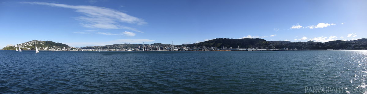
Wellington CBD from the harbour on the ferry to Somes Island
City
August 7th, 2011 on Sunday at 1:01 PM
17.3MP 118x30 Mercator
27mm f5.0 500/s ISO80
Wellington Harbour, Wellington, New Zealand
18 places and 102 pans within 305 km
Mount Victoria - 2 km South
Wellington, New Zealand
Wellington - 4 km South-West
Wellington, New Zealand
Lyall Bay - 7 km South
Wellington, New Zealand
Kapiti Coast - 37 km North
Wellington, New Zealand
Cape Palliser - 39 km South-East
Wellington, New Zealand
Picton - 68 km West
Marlborough, New Zealand
Abel Tasman National Park - 153 km West
Tasman, New Zealand
Motueka - 154 km West
Tasman, New Zealand
Kaikoura - 156 km South-West
Canterbury, New Zealand
Manawatu-Wanganui - 163 km North
Manawatu-Wanganui, New Zealand
Nelson Lakes National Park - 174 km West
Nelson, New Zealand
Tongariro National Park - 239 km North
Manawatu-Wanganui, New Zealand
Desert Road - 248 km North
Manawatu-Wanganui, New Zealand
Tongariro Alpine Crossing - 249 km North
Tongariro National Park, Manawatu-Wanganui, New Zealand
Taranaki - 269 km North-West
Taranaki, New Zealand
Punakaiki - 294 km West
West Coast, New Zealand
Hawke's Bay - 296 km North-East
Hawke's Bay, New Zealand
Lake Taupo - 305 km North
Taupo, Waikato, New Zealand
9 pans at Wellington Harbour
Wellington From Point Halswell
Point Halswell Lighthouse
BlueBridge Ferry in Wellington
Wellington CBD From The Harbour
Port Wellington
Wellington From Somes Island
Visitor Center on Somes Island
Wellington Port Cranes
Back 8 of 9
Wellington Harbour
Wellington, New Zealand
You are at the last of 9 panoranics
Click on the panoramic to zoom in
or select an option from the side
Port Charles
Waikato, New Zealand
7 more pans
December 8th, 2013
5 days later
Back
Close
## of ###
Visit
Next


 Back 8 of 9


 Close
Close

