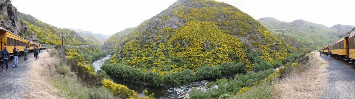
Along the Railway Taieri Gorge
MAP
River
December 15th, 2011 on Thursday at 3:55 PM
15.8MP 201x53 Cylindrical
27mm f2.0 200/s ISO80
Otago, Otago, New Zealand
administrative_area_level_1=Otago country=New Zealand
14 places and 79 pans within 176 km
Otago Peninsula - 32 km South-East
Otago, New Zealand
Dunedin - 25 km South-East
Otago, New Zealand
Omarama - 139 km North-West
Otago, New Zealand
Wanaka - 151 km West
Otago, New Zealand
Lake Tekapo - 190 km North
Canterbury, New Zealand
Arrowtown - 142 km West
Otago, New Zealand
Haast Pass - 169 km West
West Coast, New Zealand
Queenstown - 142 km West
Otago, New Zealand
Mount Cook National Park - 196 km North-West
Canterbury, New Zealand
Catlins - 119 km South-West
Southland, New Zealand
Glenorchy - 165 km West
Otago, New Zealand
West Coast - 253 km North-West
West Coast, New Zealand
Fiordland - 203 km West
Fiordland National Park, Southland, New Zealand
Southland - 176 km South-West
Southland, New Zealand
7 pans at Otago
Moeraki Boulders HDR
Moeraki Boulder Beach HDR
Waitaki Valley Elephant Rocks In 360 Degrees of HDR
Heaps of Sheeps and Elephant Rocks
Old Train in Oamaru
Oamaru Harbor Lookout
Back 6 of 7
Otago
Otago, New Zealand
You are at the last of 7 panoranics
Click on the panoramic to zoom in
or select an option from the side
Omarama
Otago, New Zealand
4 more pans
December 17th, 2011
1 day later
Back
Close
## of ###
Visit
Next


 Back 6 of 7


 Close
Close

