Florence Hill HDR
MAP
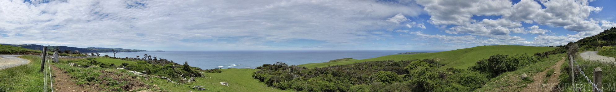
The coast line from Florence Hill Lookout in the Catlins
Bay
Sky
December 12th, 2011 on Monday at 1:56 PM
7.4MP 250x36 Cylindrical
27mm f4.0 1000/s ISO80
Catlins, Southland, New Zealand
18 places and 104 pans within 438 km
Southland - 85 km West
Southland, New Zealand
Stewart Island - 107 km West
Southland, New Zealand
Dunedin - 112 km North-East
Otago, New Zealand
Otago Peninsula - 123 km North-East
Otago, New Zealand
Queenstown - 173 km North-West
Otago, New Zealand
Otago - 169 km North-East
Otago, New Zealand
Arrowtown - 187 km North-West
Otago, New Zealand
Glenorchy - 196 km West
Otago, New Zealand
Fiordland - 212 km West
Fiordland National Park, Southland, New Zealand
Wanaka - 222 km North-West
Otago, New Zealand
Haast Pass - 240 km North-West
West Coast, New Zealand
Omarama - 238 km North
Otago, New Zealand
Mount Cook National Park - 297 km North
Canterbury, New Zealand
Lake Tekapo - 297 km North
Canterbury, New Zealand
West Coast - 353 km North
West Coast, New Zealand
Banks Peninsula - 418 km North-East
Canterbury, New Zealand
Christchurch - 420 km North-East
Canterbury, New Zealand
Arthur's Pass National Park - 438 km North
Canterbury, New Zealand
9 pans at Catlins
Curio Bay Penguin Colony 360
Cannibal Bay in HDR
Purakaunui Falls
South View of Nugget Point
North View from Nugget Point
Waipapa Point Lighthouse
Nugget Point Lighthouse Walkway
McLean Falls in HDR
Back 4 of 9
Catlins
Southland, New Zealand
You are at the 5th of 9 panoranics
Click on the panoramic to zoom in
or select an option from the side
Next 6 of 9
Back
Close
## of ###
Visit
Next


 Back 4 of 9


 Close
Close

