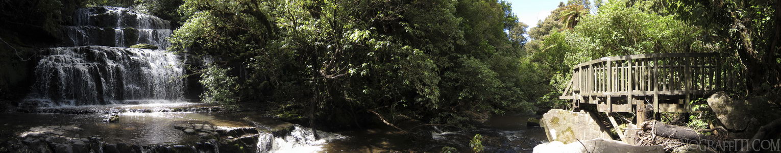
Purakaunui Falls
MAP
Purakaunui Falls and viewing deck in the Catlins
Waterfall
December 12th, 2011 on Monday at 3:33 PM
32.6MP 209x39 Cylindrical
27mm f2.0 400/s ISO80
Catlins, Southland, New Zealand
18 places and 104 pans within 429 km
Southland - 93 km West
Southland, New Zealand
Stewart Island - 117 km West
Southland, New Zealand
Dunedin - 102 km North-East
Otago, New Zealand
Otago Peninsula - 113 km North-East
Otago, New Zealand
Queenstown - 170 km West
Otago, New Zealand
Otago - 159 km North-East
Otago, New Zealand
Arrowtown - 184 km North-West
Otago, New Zealand
Glenorchy - 193 km West
Otago, New Zealand
Fiordland - 212 km West
Fiordland National Park, Southland, New Zealand
Wanaka - 217 km North-West
Otago, New Zealand
Haast Pass - 235 km North-West
West Coast, New Zealand
Omarama - 230 km North
Otago, New Zealand
Mount Cook National Park - 289 km North
Canterbury, New Zealand
Lake Tekapo - 289 km North
Canterbury, New Zealand
West Coast - 345 km North
West Coast, New Zealand
Banks Peninsula - 408 km North-East
Canterbury, New Zealand
Christchurch - 410 km North-East
Canterbury, New Zealand
Arthur's Pass National Park - 429 km North
Canterbury, New Zealand
9 pans at Catlins
Curio Bay Penguin Colony 360
Cannibal Bay in HDR
South View of Nugget Point
Florence Hill HDR
North View from Nugget Point
Waipapa Point Lighthouse
Nugget Point Lighthouse Walkway
McLean Falls in HDR
Back 2 of 9
Catlins
Southland, New Zealand
You are at the 3rd of 9 panoranics
Click on the panoramic to zoom in
or select an option from the side
Next 4 of 9
Back
Close
## of ###
Visit
Next


 Back 2 of 9


 Close
Close

