Paradise Harbor from Brown Base - Part way up the 70 meter mound by the name of Punta Proa, the Andvord Bay shows its cold and depth in dark colors
MAP

Part way up the 70 meter mound by the name of Punta Proa, the Andvord Bay shows its cold and depth in dark colors

March 12th, 2014 on Wednesday at 5:05 PM 52.5MP 215x29 Cylindrical 28mm f5.0 161/s ISO200

Paradise Bay, Antarctica Antarctica

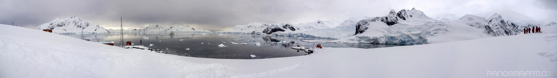
Paradise Harbor, also known as Paradise Bay, is a wide embayment behind Lemaire and Bryde Islands in Antarctica, indenting the west coast of Graham Land between Duthiers and Leniz Points. The name was first applied by whalers operating in the vicinity and was in use by 1920. It is one of only two harbors used for cruise ships to stop on the continent; the other is Neko Harbour. Argentina's Almirante Brown Antarctic Base stands on the coast of the bay, as does Chile's González Videla Antarctic Base.

Previous Pan Back 5 of 7
Paradise Bay
Paradise Bay, Antarctica

You are at the 6th of 7 panoranics

Click on the panoramic to zoom in
or select an option from the side
Next 7 of 7 Next Pan
Zoom
 
 
Panoramic
Previous
Next
Loading...