Valles Calchaquies Flood Plains - The flood plains of a river in the dry area around Valles Calchaquies
MAP

The flood plains of a river in the dry area around Valles Calchaquies

April 27th, 2014 on Sunday at 1:17 PM 36mm f5.6 1667/s ISO200

Parque Nacional los Cardones, Salta, Argentina Argentina

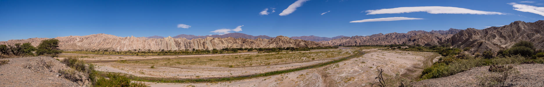
The park has an area of 650 square kilometres, with hills and ravines at the height levels between 2,700 m and 5,000 m. It gets its name from the prevalence of cardones bush formations. It features fossil remains of extinct animals, as well as dinosaur tracks.

Previous Pan Back 6 of 8
Parque Nacional los Cardones
Salta, Argentina

You are at the 7th of 8 panoranics

Click on the panoramic to zoom in
or select an option from the side
Next 8 of 8 Next Pan
Zoom
 
 
Panoramic
Previous
Next
Loading...