Fox Glacier Carve
MAP
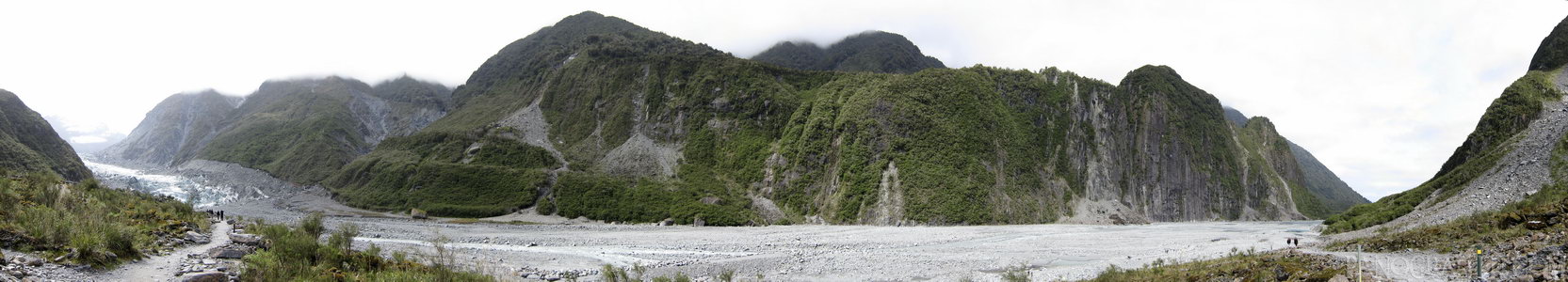
The terminus of Fox Glacier at the end of the rock path it has left behind during receede
Family
Glacier
Mountain
November 27th, 2011 on Sunday at 10:19 AM
24.7MP 227x38 Cylindrical
27mm f2.5 1000/s ISO80
West Coast, West Coast, New Zealand
administrative_area_level_1=West Coast country=New Zealand
12 places and 67 pans within 210 km
Mount Cook National Park - 50 km South
Canterbury, New Zealand
Lake Tekapo - 65 km South-East
Canterbury, New Zealand
Omarama - 108 km South
Otago, New Zealand
Arthur's Pass National Park - 138 km North-East
Canterbury, New Zealand
Haast Pass - 126 km South-West
West Coast, New Zealand
Wanaka - 138 km South-West
Otago, New Zealand
Arrowtown - 187 km South-West
Otago, New Zealand
Punakaiki - 205 km North-East
West Coast, New Zealand
Christchurch - 211 km East
Canterbury, New Zealand
Glenorchy - 205 km South-West
Otago, New Zealand
Otago - 205 km South
Otago, New Zealand
Queenstown - 210 km South-West
Otago, New Zealand
6 pans at West Coast
Fox Glacier Terminus in HDR
On Franz Josef Glacier
Mount Cook Near Lake Matheson
Skydiving In Franz Josef
Skydive Franz Josef Aeroport
Back 1 of 6
West Coast
West Coast, New Zealand
You are at the 2nd of 6 panoranics
Click on the panoramic to zoom in
or select an option from the side
Next 3 of 6
Back
Close
## of ###
Visit
Next


 Back 1 of 6


 Close
Close

