On Franz Josef Glacier
MAP
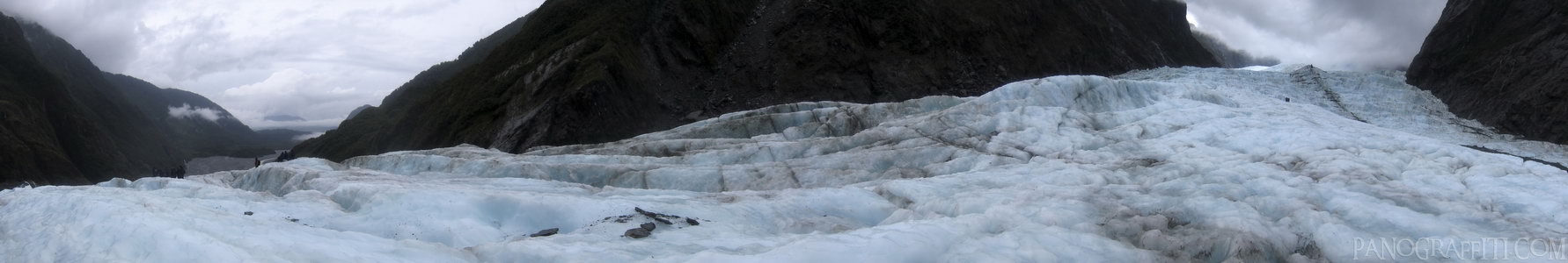
A 180 degree view looking up and down Franz Josef Glacier
Glacier
Mountain
March 27th, 2010 on Saturday at 2:41 PM
24.9MP 208x34 Cylindrical
27mm f4.5 500/s ISO80
West Coast, West Coast, New Zealand
administrative_area_level_1=West Coast country=New Zealand
12 places and 67 pans within 220 km
Mount Cook National Park - 55 km South
Canterbury, New Zealand
Lake Tekapo - 65 km South
Canterbury, New Zealand
Omarama - 114 km South
Otago, New Zealand
Arthur's Pass National Park - 126 km North-East
Canterbury, New Zealand
Haast Pass - 136 km South-West
West Coast, New Zealand
Wanaka - 148 km South-West
Otago, New Zealand
Arrowtown - 197 km South-West
Otago, New Zealand
Punakaiki - 195 km North-East
West Coast, New Zealand
Christchurch - 202 km East
Canterbury, New Zealand
Glenorchy - 215 km South-West
Otago, New Zealand
Otago - 209 km South
Otago, New Zealand
Queenstown - 220 km South-West
Otago, New Zealand
6 pans at West Coast
Fox Glacier Terminus in HDR
Fox Glacier Carve
Mount Cook Near Lake Matheson
Skydiving In Franz Josef
Skydive Franz Josef Aeroport
Back 2 of 6
West Coast
West Coast, New Zealand
You are at the 3rd of 6 panoranics
Click on the panoramic to zoom in
or select an option from the side
Next 4 of 6
Back
Close
## of ###
Visit
Next


 Back 2 of 6


 Close
Close

