Skydive Franz Josef Aeroport
MAP
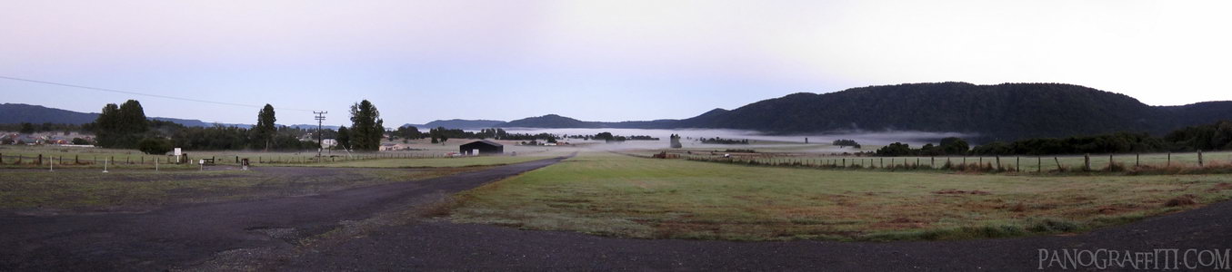
The fog hung around in the morning as eager skydivers awaited their chance to see Franz Josef Glacier from the air at 240kmh
Sky
March 28th, 2010 on Sunday at 7:35 AM
11.5MP 111x24 Cylindrical
27mm f2.0 50/s ISO800
West Coast, West Coast, New Zealand
administrative_area_level_1=West Coast country=New Zealand
12 places and 67 pans within 227 km
Mount Cook National Park - 65 km South
Canterbury, New Zealand
Lake Tekapo - 75 km South
Canterbury, New Zealand
Omarama - 123 km South
Otago, New Zealand
Arthur's Pass National Park - 125 km North-East
Canterbury, New Zealand
Haast Pass - 142 km South-West
West Coast, New Zealand
Wanaka - 154 km South-West
Otago, New Zealand
Arrowtown - 204 km South-West
Otago, New Zealand
Punakaiki - 189 km North-East
West Coast, New Zealand
Christchurch - 206 km East
Canterbury, New Zealand
Glenorchy - 221 km South-West
Otago, New Zealand
Otago - 219 km South
Otago, New Zealand
Queenstown - 227 km South-West
Otago, New Zealand
6 pans at West Coast
Fox Glacier Terminus in HDR
Fox Glacier Carve
On Franz Josef Glacier
Mount Cook Near Lake Matheson
Skydiving In Franz Josef
Back 5 of 6
West Coast
West Coast, New Zealand
You are at the last of 6 panoranics
Click on the panoramic to zoom in
or select an option from the side
Haast Pass
West Coast, New Zealand
4 more pans
November 27th, 2011
Later that day
Back
Close
## of ###
Visit
Next


 Back 5 of 6


 Close
Close

